Problem Task
This task was designed by Dr Karen Joyce and Dr Stephanie Duce as a final project for Advanced GIS Masters Coursework. Do not reproduce without permission. The following is a paraphrased version of the task.
The scenario involves a project where a global tech giant, Orange, plans to invest in renewable energy projects by building three new solar farms in the Wet Tropics Natural Resource Management region of Queensland, Australia.
The goal is to identify the three most suitable sites that meet specific criteria, including being located within the designated region, having flat topography, high solar exposure, and being within a certain distance from a populated area. The Wet Tropics Management Authority (WTMA) has requested the inclusion of two additional criteria in the site selection process.
Deliverables
- A table detailing the spatial data layers used
- A flowchart illustrating the spatial analysis tools and operations conducted
- An explanation of how the top three locations were prioritized
- A map showing the potential solar farm sites and their respective areas and locations
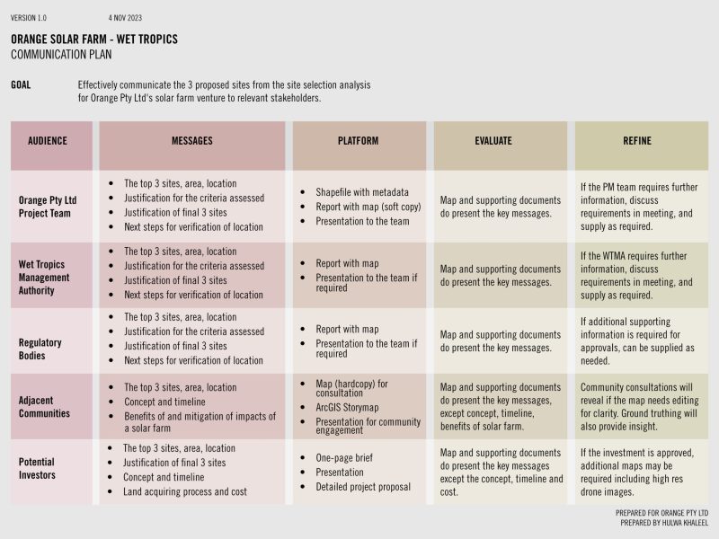
- A detailed plan for communicating the results using the principles of GAMPER
- A description of how the accuracy of the analysis can be assessed
- A justification for the selection of the additional two criteria
Tools Used
- ArcGIS Pro
- Affinity Designer
- QSpatial
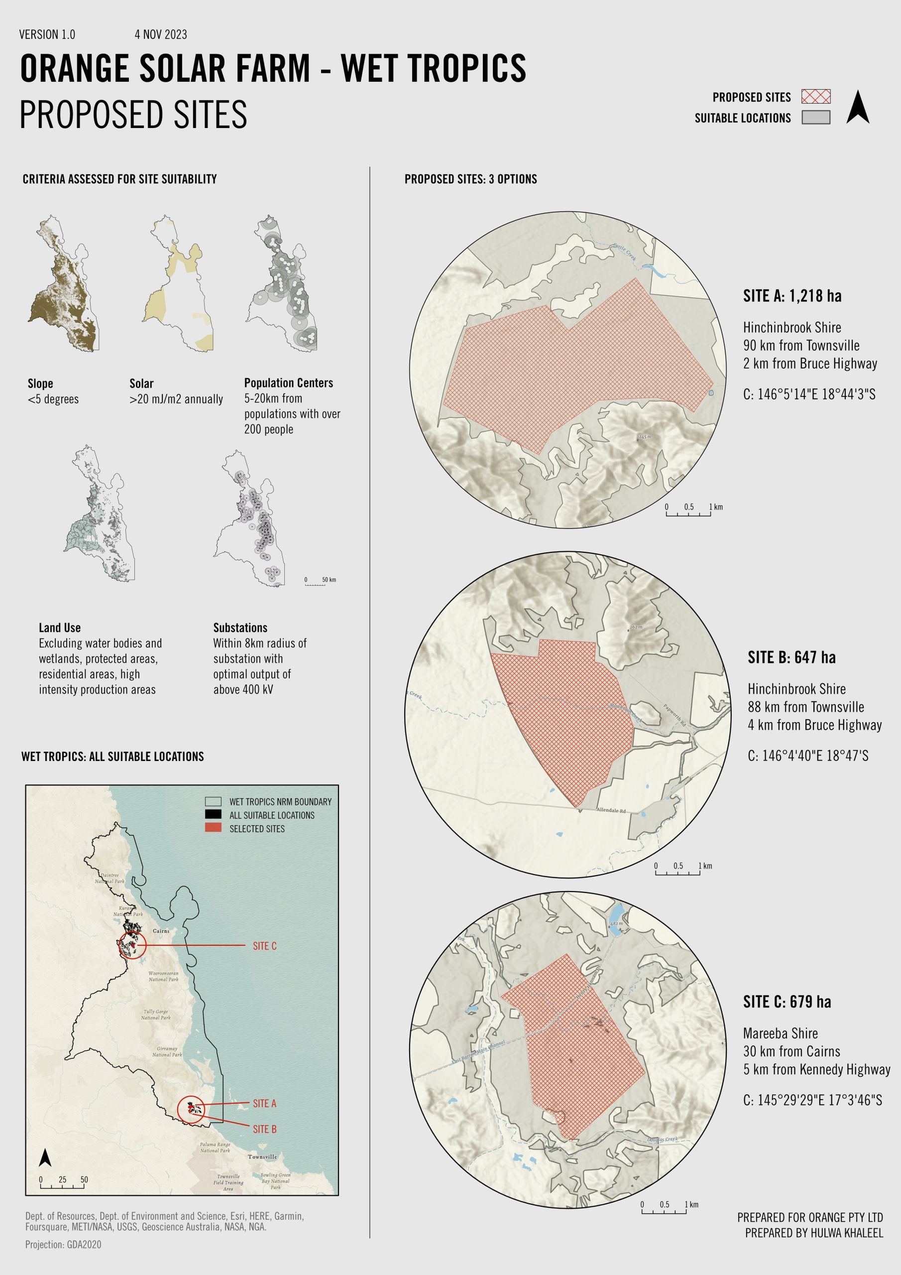
Proposed Sites
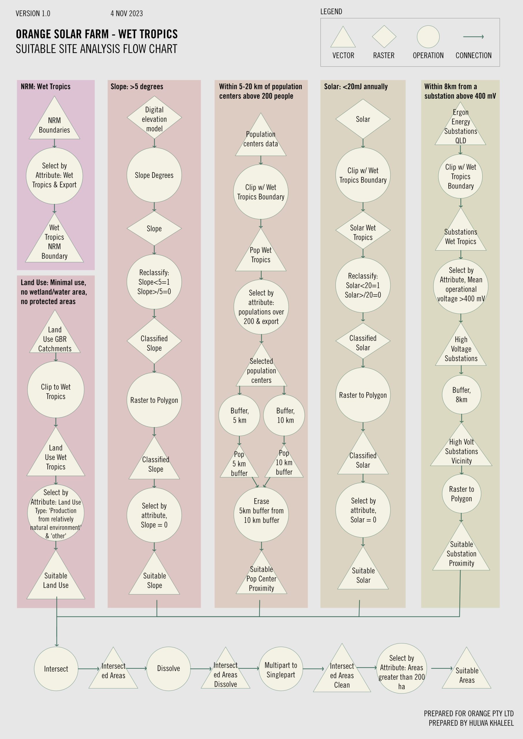
Workflow Flowchart
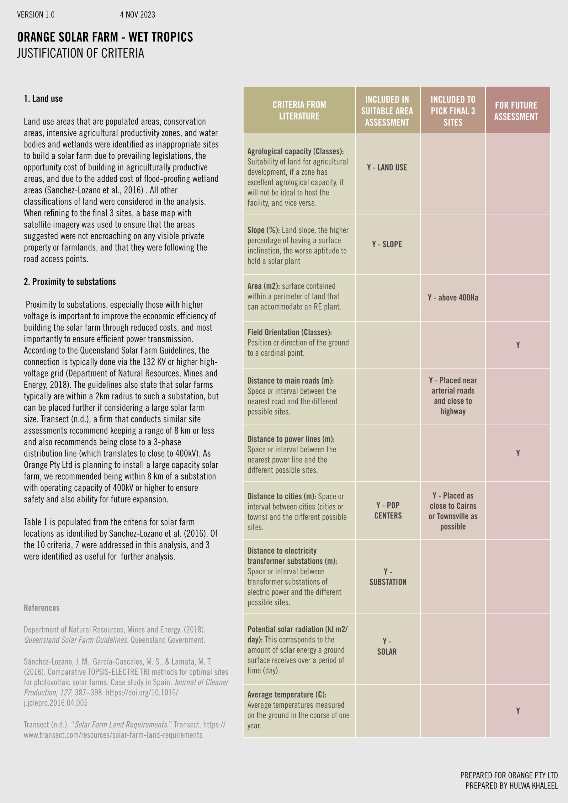
Justification of Selection Criteria
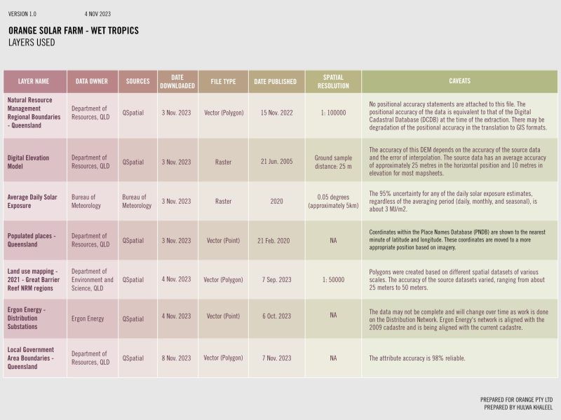
Details of Data Layers
